

The Bowline Park / rankinfraser landscape architecture


Text description provided by the architects. The Bowline is a new active travel route and elevated linear park with viewpoints that bring back into use the disused Bowling Viaduct and its listed swing bridge. The elevated travel route eliminates a dangerous road crossing on the A814, creating a new off-road section of National Cycle Route 7 connecting Glasgow to Loch Lomond and the Trossachs National Park.

The completion of The Bowline marks a significant stage in the wider regeneration of Bowling Harbour that includes the regeneration of railway arches and the public realm around the harbor. This transformational work, undertaken in partnership with the local community, has brought new businesses, activities, and economic benefits to the canal and celebrates Bowling’s important role in Scotland’s industrial past, developing a new leisure destination befitting of the western gateway to the Forth & Clyde Canal.

The design of the 700m long route is comprised of several distinct character areas that correspond to the surrounding landscape context and the three viaduct sections that span the Forth and Clyde Canal, the North Clyde rail line, and the A814. The design takes cues from the existing structures, with new steel elements inserted within key locations in order to reimagine the former industrial structure as a new destination and travel corridor. The access ramp and viewpoints are designed as contemporary reflections of the historic structures which they sit alongside, transforming the viaduct and providing it with a new lease of life for future generations.


The design of the new steel and iron elements seeks to strike a balance between respecting the existing structures yet reading as contemporary interventions, ensuring the timeline of change can be understood. They bring the visitor into contact with historic elements which have been inaccessible for years, connecting east to west, touching the canal towpath, basin, swing bridge, arches, road, and rail bridges, all the while affording views of the beautiful surrounding landscape.

Material choices and detailing reflects the industrial, robust nature of the site, with concrete, steel, and iron used to create a ‘feel’ that is particular to this place. These reflect the existing concrete and metal structures in a way that is new, recognizable, and exciting, further emphasizing Bowling’s place on the map.

Planting complements and further emphasizes the design through a combination of woodland planting in the east and west, out of which the viaduct and bridge structures emerge, and colorful carpets of ground cover species capable of growing within the thin soil depths on the bridges. Blocks of Birch trees evoke the period of dereliction that saw the self-seeding of pioneer species, as nature began to re-emerge on the site.

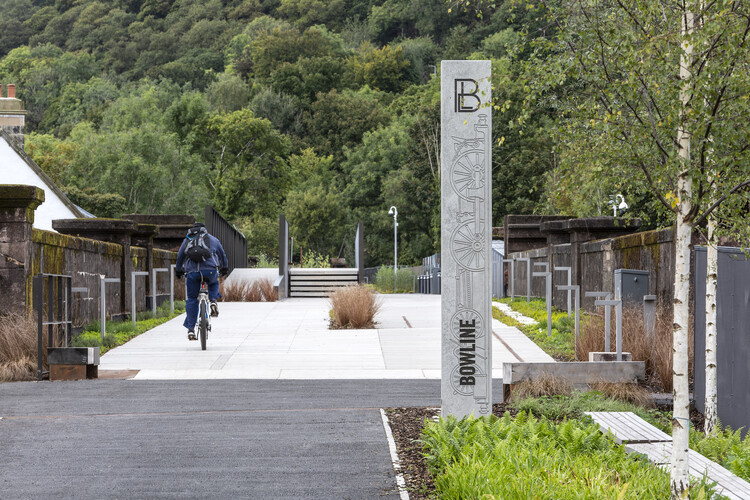
After darkness, lighting at the Bowline has been designed to enhance the newly restored Swing Bridge and Road Bridge historic girder bridge structures with integrated dynamic color change LED feature lighting. Interpretive graphics and bespoke way-finding totems have been sensitively integrated into the overall landscape design. These assist with way-finding whilst bringing to life and communicating stories of the site’s history.

Project gallery
Project location
Address:Bowling, West Dunbartonshire, Scotland

Location to be used only as a reference. It could indicate city/country but not exact address.
About this office

Cite: “The Bowline Park / rankinfraser landscape architecture” 02 Aug 2022. ArchDaily. Accessed .
Did you know?
You’ll now receive updates based on what you follow! Personalize your stream and start following your favorite authors, offices and users.